
Displaying PyBossa Urban Parks Data on a 3D Globe
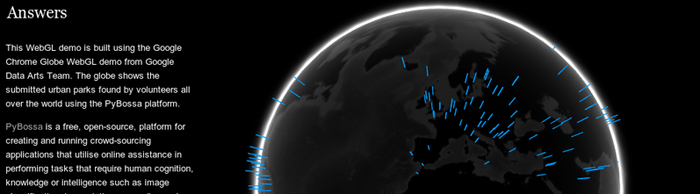
Labs member Daniel Lombraña González has built a 3-d globe showing the locatoins of urban parks around the world as located by volunteers using the Pybossa Urban Park geocoding app:
http://teleyinex.github.com/pybossa-urbanpark-globe/ — (Source code)

Background
The Urban Parks geo-coding application is a micro-tasking app running on PyBossa. In the app volunteers are asked to find an urban park for cities around the world. The volunteers use a web map to browse the city, and then submit an answer: the coordinates of the urban park by placing a marker in the map, or saying: I don’t find any park.
More details about PyBossa can be found on the official site http://pybossa.com and also in the online documentation.
 We make tools, apps and insights using
open stuff
We make tools, apps and insights using
open stuff


Comments